
Carte topographique Bishop's Beach
Carte interactive
Cliquez sur la carte pour afficher l’altitude.
À propos de cette carte
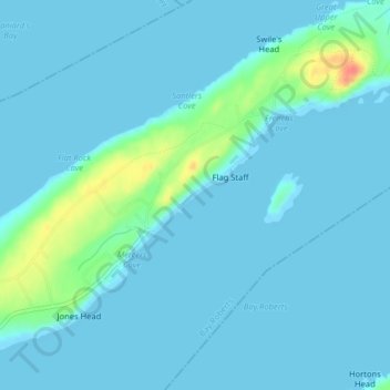
Nom : Carte topographique Bishop's Beach, altitude, relief.
Altitude moyenne : 7 m
Altitude minimum : -1 m
Altitude maximum : 54 m
Autres cartes topographiques
Cliquez sur une carte pour visualiser sa topographie, son altitude et son relief.
Bay Roberts
Canada > Newfoundland and Labrador > Bay Roberts
Bay Roberts, Newfoundland, Newfoundland and Labrador, A0A 1G0, Canada
Altitude moyenne : 44 m