
Carte topographique Grogan's Mill
Carte interactive
Cliquez sur la carte pour afficher l’altitude.
À propos de cette carte
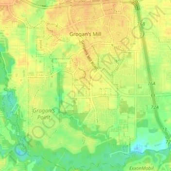
Nom : Carte topographique Grogan's Mill, altitude, relief.
Altitude moyenne : 40 m
Altitude minimum : 23 m
Altitude maximum : 50 m
Autres cartes topographiques
Cliquez sur une carte pour visualiser sa topographie, son altitude et son relief.
Indian Springs
United States > Texas > Montgomery County > The Woodlands
Indian Springs, The Woodlands, Montgomery County, Texas, United States
Altitude moyenne : 48 m
College Park
United States > Texas > Montgomery County > The Woodlands
College Park, The Woodlands, Montgomery County, Texas, United States
Altitude moyenne : 47 m
Alden Bridge
United States > Texas > Montgomery County > The Woodlands
Alden Bridge, The Woodlands, Montgomery County, Texas, 77382, United States
Altitude moyenne : 55 m