
Carte topographique Batanes
Carte interactive
Cliquez sur la carte pour afficher l’altitude.
À propos de cette carte
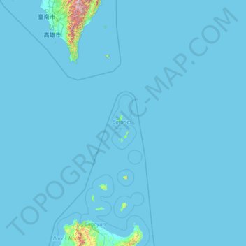
Nom : Carte topographique Batanes, altitude, relief.
Lieu : Batanes, Cagayan Valley, Philippinen (18.08425 119.33395 23.20425 124.45395)
Altitude moyenne : 25 m
Altitude minimum : -1 m
Altitude maximum : 3 153 m
Autres cartes topographiques
Cliquez sur une carte pour visualiser sa topographie, son altitude et son relief.
Itbayat
Philippinen > Batanes > Itbayat
Itbayat, Batanes, Cagayan Valley, 3905, Philippinen
Altitude moyenne : 31 m
Batan Islands
Philippinen > Batanes > Basco
Batan Islands, Basco, Batanes, Cagayan Valley, 3900, Philippinen
Altitude moyenne : 0 m