
Carte topographique Sisak
Carte interactive
Cliquez sur la carte pour afficher l’altitude.
Sisak
Sisak (Croatian: ; Hungarian: Sziszek ; also known by other alternative names) is a city in central Croatia, spanning the confluence of the Kupa, Sava and Odra rivers, 57 km (35 mi) southeast of the Croatian capital Zagreb, and is usually considered to be where the Posavina (Sava basin) begins, with an elevation of 99 m. The city's total population in 2011 was 47,768 of which 33,322 live in the urban settlement (naselje).
À propos de cette carte
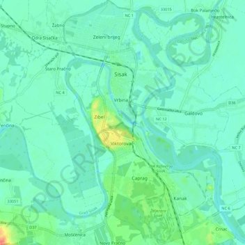
Nom : Carte topographique Sisak, altitude, relief.
Lieu : Sisak, Grad Sisak, Sisak-Moslavina County, Croatia (45.43627 16.34912 45.51211 16.43201)
Altitude moyenne : 99 m
Altitude minimum : 87 m
Altitude maximum : 146 m