
Carte topographique Gaishorn
Carte interactive
Cliquez sur la carte pour afficher l’altitude.
À propos de cette carte
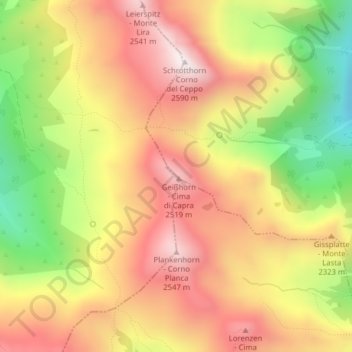
Nom : Carte topographique Gaishorn, altitude, relief.
Lieu : Gaishorn, Vahrn, Eisacktal, Bozen, Trentino-Südtirol, Italien (46.72407 11.51107 46.72417 11.51117)
Altitude moyenne : 2 231 m
Altitude minimum : 1 798 m
Altitude maximum : 2 570 m
Autres cartes topographiques
Cliquez sur une carte pour visualiser sa topographie, son altitude et son relief.
Vahrn
Italien > Trentino-Südtirol > Vahrn > Vahrn
Vahrn, Eisacktal, Bozen, Trentino-Südtirol, Italien
Altitude moyenne : 1 257 m