
Carte topographique Sungai Dungun
Carte interactive
Cliquez sur la carte pour afficher l’altitude.
À propos de cette carte
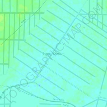
Nom : Carte topographique Sungai Dungun, altitude, relief.
Altitude moyenne : 4 m
Altitude minimum : 0 m
Altitude maximum : 10 m
Autres cartes topographiques
Cliquez sur une carte pour visualiser sa topographie, son altitude et son relief.
Terentang
Indonesia > West Kalimantan > Kubu Raya
Terentang, Kubu Raya, West Kalimantan, Indonesia
Altitude moyenne : 8 m
Punggur Kecil
Indonesia > West Kalimantan > Kubu Raya > Punggur Kecil
Punggur Kecil, Sungai Kakap, Kubu Raya, West Kalimantan, 78381, Indonesia
Altitude moyenne : 2 m
Punggur Besar
Indonesia > West Kalimantan > Kubu Raya > Punggur Besar
Punggur Besar, Sungai Kakap, Kubu Raya, West Kalimantan, Indonesia
Altitude moyenne : 3 m
Sungai Raya
Indonesia > West Kalimantan > Kubu Raya > Sungai Raya
Sungai Raya, Kubu Raya, West Kalimantan, Indonesia
Altitude moyenne : 7 m