
Carte topographique Werychów
Carte interactive
Cliquez sur la carte pour afficher l’altitude.
À propos de cette carte
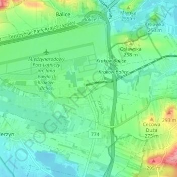
Nom : Carte topographique Werychów, altitude, relief.
Altitude moyenne : 238 m
Altitude minimum : 212 m
Altitude maximum : 309 m
Autres cartes topographiques
Cliquez sur une carte pour visualiser sa topographie, son altitude et son relief.
Balice
Poland > Lesser Poland Voivodeship > Kraków County > Balice
Balice, gmina Zabierzów, Kraków County, Lesser Poland Voivodeship, 32-083, Poland
Altitude moyenne : 254 m