
Carte topographique Hultaklint
Carte interactive
Cliquez sur la carte pour afficher l’altitude.
À propos de cette carte
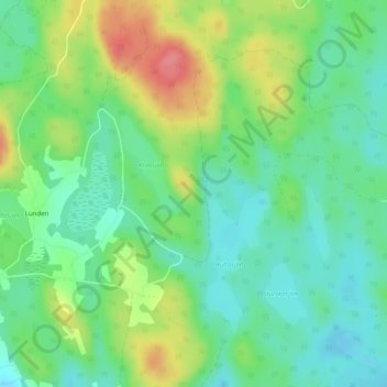
Nom : Carte topographique Hultaklint, altitude, relief.
Altitude moyenne : 244 m
Altitude minimum : 215 m
Altitude maximum : 298 m
Autres cartes topographiques
Cliquez sur une carte pour visualiser sa topographie, son altitude et son relief.
Växjö
Sweden > Kronoberg County > Växjö
Växjö, Växjö kommun, Kronoberg County, Region Götaland, 351 04, Sweden
Altitude moyenne : 174 m