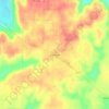
Carte topographique Eva
Cliquez sur la carte pour afficher l’altitude.
Eva
According to the U.S. Census Bureau, the town of Eva has a total area of 4.3 square miles (11 km2), of which 0.03 square miles (0.08 km2), or 0.74%, are water. The town center, at an elevation of 1,105 feet (337 m) above sea level, is just north of the Tennessee Valley Divide. The town drains west toward Flint Creek and east toward Cotaco Creek, both of which are north-flowing tributaries of the Tennessee River. The southernmost parts of town drain south to Eightmile Creek, a tributary of the Broglen River and part of the Mulberry Fork of the Black Warrior River watershed.
À propos de cette carte

Nom : Carte topographique Eva, altitude, relief.
Lieu : Eva, Morgan County, Alabama, United States (34.30656 -86.78903 34.35278 -86.72290)
Altitude moyenne : 313 m
Altitude minimum : 204 m
Altitude maximum : 351 m
Autres cartes topographiques
Cliquez sur une carte pour visualiser sa topographie, son altitude et son relief.