
Carte topographique Ponferrada
Carte interactive
Cliquez sur la carte pour afficher l’altitude.
À propos de cette carte
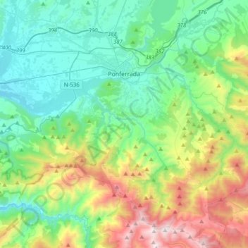
Nom : Carte topographique Ponferrada, altitude, relief.
Lieu : Ponferrada, El Bierzo, León, Castile and León, Spain (42.38622 -6.71411 42.61270 -6.40717)
Altitude moyenne : 883 m
Altitude minimum : 424 m
Altitude maximum : 2 136 m
Autres cartes topographiques
Cliquez sur une carte pour visualiser sa topographie, son altitude et son relief.
A Corona
Spain > Castile and León > El Bierzo > Candín
A Corona, Candín, El Bierzo, León, Castile and León, 24433, Spain
Altitude moyenne : 985 m
Los Polines
Spain > Castile and León > El Bierzo > Noceda del Bierzo
Los Polines, Noceda del Bierzo, El Bierzo, León, Castile and León, 24319, Spain
Altitude moyenne : 900 m