
Carte topographique The Borough District of Drogheda
Carte interactive
Cliquez sur la carte pour afficher l’altitude.
À propos de cette carte
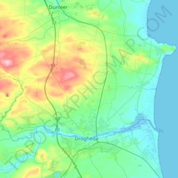
Nom : Carte topographique The Borough District of Drogheda, altitude, relief.
Altitude moyenne : 50 m
Altitude minimum : -1 m
Altitude maximum : 209 m
Autres cartes topographiques
Cliquez sur une carte pour visualiser sa topographie, son altitude et son relief.
Dundalk
Irlande > County Louth > Dundalk
Dundalk, The Municipal District of Dundalk, County Louth, Leinster, A91 RC44, Irlande
Altitude moyenne : 16 m