
Carte topographique Lyndon
Carte interactive
Cliquez sur la carte pour afficher l’altitude.
Lyndon
The highest point in Lyndon is Diamond Hill in the southwest, with an elevation of slightly greater than 1,640 feet (500 m).[13]
À propos de cette carte
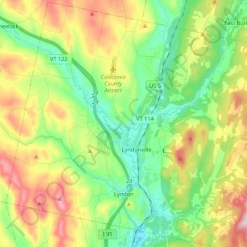
Nom : Carte topographique Lyndon, altitude, relief.
Lieu : Lyndon, Caledonia County, Vermont, United States (44.49135 -72.08354 44.59842 -71.93155)
Altitude moyenne : 317 m
Altitude minimum : 183 m
Altitude maximum : 542 m