
Carte topographique Garoowe
Carte interactive
Cliquez sur la carte pour afficher l’altitude.
À propos de cette carte
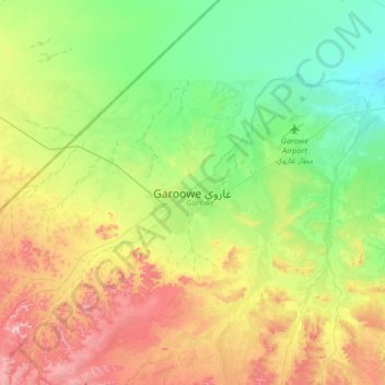
Nom : Carte topographique Garoowe, altitude, relief.
Lieu : Garoowe, Garowe District, Nugaal, Puntland, Somalia (8.24614 48.32320 8.56614 48.64320)
Altitude moyenne : 486 m
Altitude minimum : 395 m
Altitude maximum : 645 m
Garowe is situated in the Nugaal Valley, bounded by gradually ascending high plateaus that generally reach elevations of 500 to 1,000 metres (1,600 to 3,300 feet) above sea level on the north, west, and south. The western part of the same plateau is crossed by numerous valleys and dry watercourses. Raising livestock forms the basis of the economy, and frankincense and myrrh are collected from the wild trees.[7]