
Carte topographique Pagar Alam
Carte interactive
Cliquez sur la carte pour afficher l’altitude.
Pagar Alam
Pagaralam is located by the Bukit Barisan Mountains, at the feet of Mount Dempo. Much of the soil in the city consists of latosol and andisol with rugged and hilly topography. The soil in this city is classified as soil with high fertility (class I).
À propos de cette carte
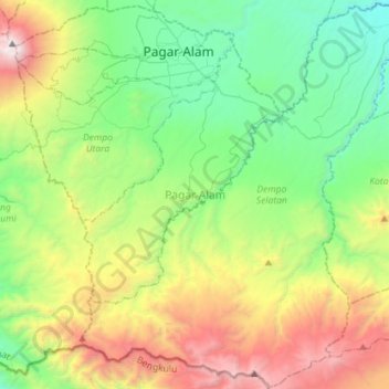
Nom : Carte topographique Pagar Alam, altitude, relief.
Lieu : Pagar Alam, South Sumatra, Indonesia (-4.26717 103.13002 -3.98478 103.41541)
Altitude moyenne : 1 289 m
Altitude minimum : 400 m
Altitude maximum : 3 151 m