
Carte topographique Chorley
Cliquez sur la carte pour afficher l’altitude.
À propos de cette carte
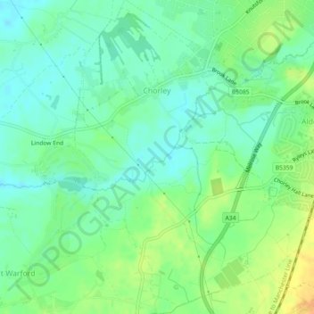
Nom : Carte topographique Chorley, altitude, relief.
Lieu : Chorley, Cheshire East, England, United Kingdom (53.28987 -2.27380 53.31562 -2.23953)
Altitude moyenne : 73 m
Altitude minimum : 61 m
Altitude maximum : 92 m
Autres cartes topographiques
Cliquez sur une carte pour visualiser sa topographie, son altitude et son relief.
Whirley Grove
United Kingdom > England > Cheshire East > Macclesfield > Whirley Grove
Altitude moyenne : 154 m
Peckforton Moss
United Kingdom > England > Cheshire East > Bulkeley > Peckforton
Altitude moyenne : 100 m
Shining Tor
United Kingdom > England > Cheshire East
Shining Tor is the highest hill in Cheshire, England. The summit has an elevation of 559 m (1,834 ft) above sea level. It is in the Peak District, between the towns of Macclesfield in Cheshire and Buxton in Derbyshire, and is on the administrative boundary between Derbyshire and Cheshire East. The hill is at…
Altitude moyenne : 440 m
Higher Poynton
United Kingdom > England > Cheshire East > Poynton > Higher Poynton
Altitude moyenne : 157 m