
Carte topographique Renauds Mills
Carte interactive
Cliquez sur la carte pour afficher l’altitude.
À propos de cette carte
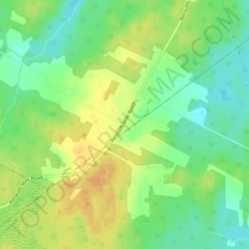
Nom : Carte topographique Renauds Mills, altitude, relief.
Altitude moyenne : 49 m
Altitude minimum : 33 m
Altitude maximum : 65 m
Autres cartes topographiques
Cliquez sur une carte pour visualiser sa topographie, son altitude et son relief.
Saint-Joseph-de-Kent
Canada > New Brunswick > Wellington Parish
Saint-Joseph-de-Kent, Wellington Parish, Kent County, New Brunswick, E4S 4G4, Canada
Altitude moyenne : 20 m