
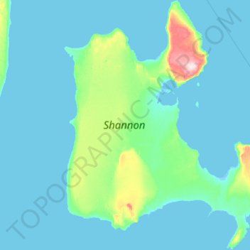
Carte topographique Shannon Island
Carte interactive
Cliquez sur la carte pour afficher l’altitude.
À propos de cette carte
Nom : Carte topographique Shannon Island, altitude, relief.
Lieu : Shannon Island, Sermersooq, Greenland (74.92913 -18.92286 75.42671 -17.30225)
Altitude moyenne : 18 m
Altitude minimum : -5 m
Altitude maximum : 300 m
Autres cartes topographiques
Cliquez sur une carte pour visualiser sa topographie, son altitude et son relief.
Traill-iup Immikkeertivi
Traill-iup Immikkeertivi, Sermersooq, Greenland
Altitude moyenne : 0 m
Geographical Society Island
Geographical Society Island, Sermersooq, Greenland
Altitude moyenne : 178 m