
Carte topographique Ao Khanom
Carte interactive
Cliquez sur la carte pour afficher l’altitude.
À propos de cette carte
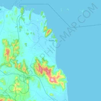
Nom : Carte topographique Ao Khanom, altitude, relief.
Lieu : Ao Khanom, Nakhon Si Thammarat Province, 80210, Thailand (9.02293 99.69737 9.34293 100.01737)
Altitude moyenne : 48 m
Altitude minimum : 0 m
Altitude maximum : 783 m
Autres cartes topographiques
Cliquez sur une carte pour visualiser sa topographie, son altitude et son relief.
Khanom
Thailand > Nakhon Si Thammarat Province > Khanom
Khanom, Ao Khanom, Nakhon Si Thammarat Province, 80210, Thailand
Altitude moyenne : 27 m
Ban Khao Wang Tong
Thailand > Nakhon Si Thammarat Province > Ban Khao Wang Tong
Ban Khao Wang Tong, Nakhon Si Thammarat Province, Thailand
Altitude moyenne : 39 m