
Carte topographique Ostern
Carte interactive
Cliquez sur la carte pour afficher l’altitude.
À propos de cette carte
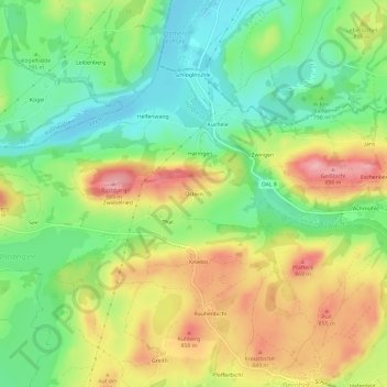
Nom : Carte topographique Ostern, altitude, relief.
Altitude moyenne : 798 m
Altitude minimum : 735 m
Altitude maximum : 881 m
Autres cartes topographiques
Cliquez sur une carte pour visualiser sa topographie, son altitude et son relief.
Hochplatte
Deutschland > Bayern > Landkreis Ostallgäu > Halblech
Hochplatte, Halblech, Landkreis Ostallgäu, Bayern, Deutschland
Altitude moyenne : 1 646 m
Hirschwang
Deutschland > Bayern > Landkreis Ostallgäu > Halblech
Hirschwang, Halblech, Landkreis Ostallgäu, Bayern, Deutschland
Altitude moyenne : 1 481 m