
Carte topographique Rimbuhl
Carte interactive
Cliquez sur la carte pour afficher l’altitude.
À propos de cette carte
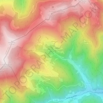
Nom : Carte topographique Rimbuhl, altitude, relief.
Altitude moyenne : 911 m
Altitude minimum : 431 m
Altitude maximum : 1 281 m
Autres cartes topographiques
Cliquez sur une carte pour visualiser sa topographie, son altitude et son relief.
Petit Ballon
France > Grand Est > Haut-Rhin > Linthal
Petit Ballon, Linthal, Thann-Guebwiller, Haut-Rhin, Grand Est, France métropolitaine, 68610, France
Altitude moyenne : 1 050 m
Gustermatt
France > Grand Est > Haut-Rhin > Linthal
Gustermatt, Linthal, Thann-Guebwiller, Haut-Rhin, Grand Est, France métropolitaine, 68610, France
Altitude moyenne : 1 052 m