
Carte topographique Town of Philipstown
Carte interactive
Cliquez sur la carte pour afficher l’altitude.
À propos de cette carte
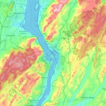
Nom : Carte topographique Town of Philipstown, altitude, relief.
Lieu : Town of Philipstown, Putnam County, New York, United States (41.32178 -73.98253 41.49854 -73.83707)
Altitude moyenne : 178 m
Altitude minimum : -3 m
Altitude maximum : 478 m