
Carte topographique Nissewaard
Carte interactive
Cliquez sur la carte pour afficher l’altitude.
À propos de cette carte
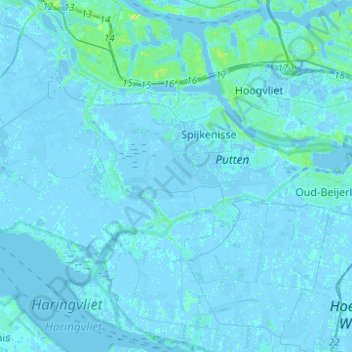
Nom : Carte topographique Nissewaard, altitude, relief.
Lieu : Nissewaard, Südholland, Niederlande (51.78277 4.18527 51.87299 4.43248)
Altitude moyenne : 1 m
Altitude minimum : -6 m
Altitude maximum : 24 m
Autres cartes topographiques
Cliquez sur une carte pour visualiser sa topographie, son altitude et son relief.
Hoeksche Waard
Niederlande > Südholland > Hoeksche Waard
Hoeksche Waard, Südholland, Niederlande
Altitude moyenne : 0 m
Mijnsheerenland
Niederlande > Südholland > Hoeksche Waard
Mijnsheerenland, Hoeksche Waard, Südholland, Niederlande
Altitude moyenne : 0 m
Bergschenhoek
Niederlande > Südholland > Lansingerland
Bergschenhoek, Lansingerland, Südholland, Niederlande
Altitude moyenne : -3 m