
Carte topographique Bowron Lake Provincial Park
Carte interactive
Cliquez sur la carte pour afficher l’altitude.
Bowron Lake Provincial Park
Bears are quite common in the park – black bears are numerous in the lower altitudes around the lake, and grizzly bears frequent the alpine areas. In addition to its bears, Bowron Lake Park is home to predators like cougars, wolves, wolverines, and lynx.
À propos de cette carte
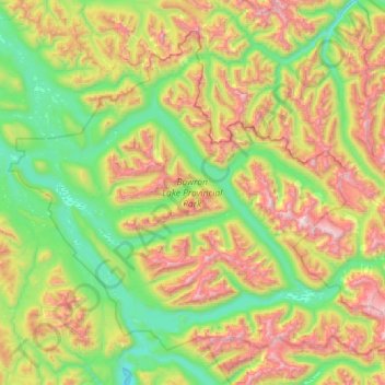
Nom : Carte topographique Bowron Lake Provincial Park, altitude, relief.
Altitude moyenne : 1 444 m
Altitude minimum : 818 m
Altitude maximum : 2 657 m