
Carte topographique Kadifekale
Carte interactive
Cliquez sur la carte pour afficher l’altitude.
Kadifekale
Kadifekale (literally "the velvet castle" in Turkish) is a hilltop castle in İzmir, Turkey. The castle is located on the Mount Pagos (Greek: Πάγος, Pagus under the Roman Empire) which has an elevation of 186 metres. It was built in the 3rd century BC. The castle is located at a distance of about 2 km from the shoreline and commands a general view of a large part of the city of İzmir, as well as of the Gulf of İzmir.
À propos de cette carte
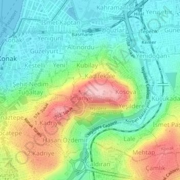
Nom : Carte topographique Kadifekale, altitude, relief.
Altitude moyenne : 65 m
Altitude minimum : 0 m
Altitude maximum : 186 m
Autres cartes topographiques
Cliquez sur une carte pour visualiser sa topographie, son altitude et son relief.