
Merci de soutenir ce site ❤️
Faire un don
Faire un don
Équipez-vous pour votre prochaine aventure :
🥾Chaussures de trekking - Chaussures techniques adaptées aux longues marches et aux terrains exigeants
En tant que Partenaire Amazon, ce site perçoit une commission sur les achats éligibles sans surcoût pour vous.
Carte topographique Tauranga
Cliquez sur la carte pour afficher l’altitude.
Merci de soutenir ce site ❤️
Faire un don
Faire un don
Équipez-vous pour votre prochaine aventure :
En tant que Partenaire Amazon, ce site perçoit une commission sur les achats éligibles sans surcoût pour vous.
À propos de cette carte
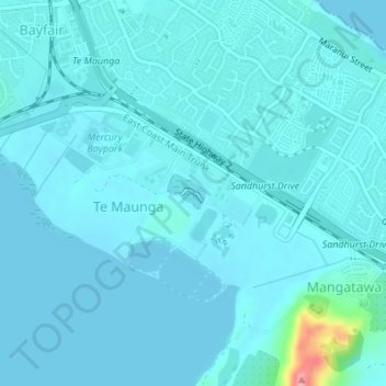
Nom : Carte topographique Tauranga, altitude, relief.
Lieu : Tauranga, Tauranga City, Bay of Plenty, New Zealand (-37.68986 176.23284 -37.68969 176.23301)
Altitude moyenne : 10 m
Altitude minimum : -1 m
Altitude maximum : 111 m
Merci de soutenir ce site ❤️
Faire un don
Faire un don
Équipez-vous pour votre prochaine aventure :
En tant que Partenaire Amazon, ce site perçoit une commission sur les achats éligibles sans surcoût pour vous.