
Carte topographique Kerrohan
Carte interactive
Cliquez sur la carte pour afficher l’altitude.
À propos de cette carte
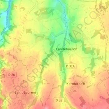
Nom : Carte topographique Kerrohan, altitude, relief.
Altitude moyenne : 95 m
Altitude minimum : 46 m
Altitude maximum : 131 m
Autres cartes topographiques
Cliquez sur une carte pour visualiser sa topographie, son altitude et son relief.
Grand Bois
France > Bretagne > Côtes-d'Armor > Landebaëron > Grand Bois
Grand Bois, Landebaëron, Guingamp, Côtes-d'Armor, Bretagne, France métropolitaine, 22140, France
Altitude moyenne : 106 m