
Carte topographique North Thomas Lake
Carte interactive
Cliquez sur la carte pour afficher l’altitude.
À propos de cette carte
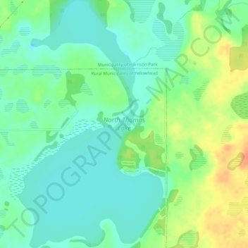
Nom : Carte topographique North Thomas Lake, altitude, relief.
Altitude moyenne : 596 m
Altitude minimum : 581 m
Altitude maximum : 622 m
Autres cartes topographiques
Cliquez sur une carte pour visualiser sa topographie, son altitude et son relief.
Elphinstone
Canada > Manitoba > Division No. 15 > Rural Municipality of Yellowhead
Elphinstone, Rural Municipality of Yellowhead, Division No. 15, Manitoba, Canada
Altitude moyenne : 583 m