
Carte topographique Conklin
Carte interactive
Cliquez sur la carte pour afficher l’altitude.
À propos de cette carte
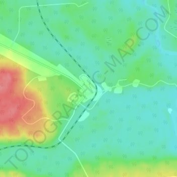
Nom : Carte topographique Conklin, altitude, relief.
Lieu : Conklin, Wood Buffalo, Alberta, T0P 1H0, Canada (55.61250 -111.10278 55.65250 -111.06278)
Altitude moyenne : 571 m
Altitude minimum : 550 m
Altitude maximum : 623 m
Conklin is a hamlet in northern Alberta, Canada within the Regional Municipality (RM) of Wood Buffalo. It is located on Highway 881 between Fort McMurray and Lac La Biche. It lies near the west end of Christina Lake at an elevation of 575 metres (1,886 ft), and was named for John Conklin, a railroad employee.
Autres cartes topographiques
Cliquez sur une carte pour visualiser sa topographie, son altitude et son relief.
Christina Lake
Canada > Alberta > Wood Buffalo > Conklin
Christina Lake, Conklin, Wood Buffalo, Alberta, Canada
Altitude moyenne : 573 m