
Carte topographique สังขละบุรี
Carte interactive
Cliquez sur la carte pour afficher l’altitude.
À propos de cette carte
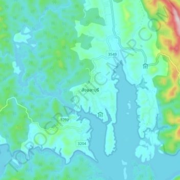
Nom : Carte topographique สังขละบุรี, altitude, relief.
Lieu : สังขละบุรี, Kanchanaburi, 71240, Thaïlande (15.11487 98.41190 15.19487 98.49190)
Altitude moyenne : 206 m
Altitude minimum : 143 m
Altitude maximum : 579 m
Autres cartes topographiques
Cliquez sur une carte pour visualiser sa topographie, son altitude et son relief.
Kanchanaburi
Kanchanaburi, ปากแพรก, Kanchanaburi, 71000, Thaïlande
Altitude moyenne : 46 m