
Carte topographique Eastern Ghats
Carte interactive
Cliquez sur la carte pour afficher l’altitude.
À propos de cette carte
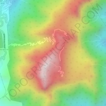
Nom : Carte topographique Eastern Ghats, altitude, relief.
Altitude moyenne : 1 130 m
Altitude minimum : 777 m
Altitude maximum : 1 494 m
The Maliya Range is located in the northern portion of the Eastern Ghats, generally ranging between elevations of 900–1,200 m. The tallest peak in this range is Mahendragiri (1,501 m).
Autres cartes topographiques
Cliquez sur une carte pour visualiser sa topographie, son altitude et son relief.
Mahendragiri
India > Odisha > Ramagiri > Burakhat
Mahendragiri, Burakhat, Ramagiri, Gajapati District, Odisha, India
Altitude moyenne : 1 108 m