
Carte topographique Trobriand Islands
Carte interactive
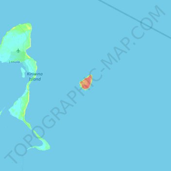
Cliquez sur la carte pour afficher l’altitude.
À propos de cette carte
Nom : Carte topographique Trobriand Islands, altitude, relief.
Altitude moyenne : 1 m
Altitude minimum : -1 m
Altitude maximum : 92 m
The Trobriands consist of four main islands, the largest being Kiriwina Island, and the others being Kaileuna, Vakuta and Kitava. Kiriwina is 43 kilometres (27 miles) long, and varies in width from 1 to 16 kilometres (0.62 to 9.94 mi). In the 1980s, there were around sixty villages on the island, containing around 12,000 people, while the other islands were restricted to a population of hundreds. Other than some elevation on Kiriwina, the islands are flat coral atolls and "remain hot and humid throughout the year, with frequent rainfall."
Autres cartes topographiques
Cliquez sur une carte pour visualiser sa topographie, son altitude et son relief.
Bwagaoia
Papua New Guinea > Milne Bay > Bwagaoia
Bwagaoia, Milne Bay, Papua Region, Papua New Guinea
Altitude moyenne : 37 m
D'Entrecasteaux Islands
D'Entrecasteaux Islands, Milne Bay, Southern Region, Papua New Guinea
Altitude moyenne : 76 m
Bushy Islet
Bushy Islet, Misima District, Milne Bay, Papua Region, Papua New Guinea
Altitude moyenne : 1 m
Woodlark Island
Woodlark Island, Losuia District, Milne Bay, Papua Region, Papua New Guinea
Altitude moyenne : 9 m
D’Entrecasteaux Islands
D’Entrecasteaux Islands, Esa’ala District, Milne Bay, Papua Region, Papua New Guinea
Altitude moyenne : 102 m
Goodenough Island
Goodenough Island, Esa’ala District, Milne Bay, Papua Region, Papua New Guinea
Altitude moyenne : 103 m
Alotau
Papua New Guinea > Milne Bay > Alotau
Alotau, Milne Bay District, Milne Bay, Papua Region, Papua New Guinea
Altitude moyenne : 117 m
Samarai Island
Samarai Island, Milne Bay District, Milne Bay, Papua Region, Papua New Guinea
Altitude moyenne : 39 m
Sideia Island
Sideia Island, Milne Bay District, Milne Bay, Papua Region, Papua New Guinea
Altitude moyenne : 30 m
Mount Vineuo
Mount Vineuo, Esa’ala District, Milne Bay, Papua Region, Papua New Guinea
Altitude moyenne : 1 984 m
Shortland Island
Shortland Island, Milne Bay District, Milne Bay, Papua Region, Papua New Guinea
Altitude moyenne : 4 m