
Carte topographique Arciprestazgo de Alcalá Sur
Carte interactive
Cliquez sur la carte pour afficher l’altitude.
À propos de cette carte
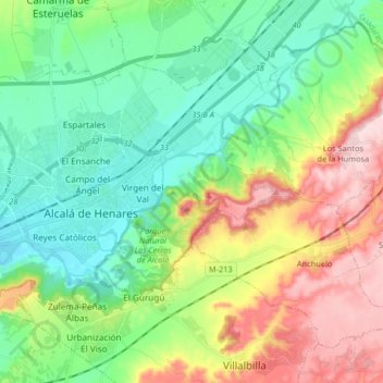
Nom : Carte topographique Arciprestazgo de Alcalá Sur, altitude, relief.
Altitude moyenne : 685 m
Altitude minimum : 576 m
Altitude maximum : 899 m
Standing at an average altitude of 654 m, and occupying some 88 km2; the city was for a long time contained in between the Henares to the South and the Madrid-Barcelona railway to the North. However, the increasing population brought on the sprawl of the urbanised area to the area located in between the railway and the A-2 motorway and beyond.