
Carte topographique Եղեգնաձոր
Carte interactive
Cliquez sur la carte pour afficher l’altitude.
À propos de cette carte
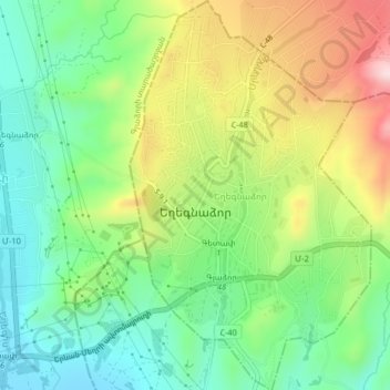
Nom : Carte topographique Եղեգնաձոր, altitude, relief.
Lieu : Եղեգնաձոր, Եղեգնաձորի տարածաշրջան, Vayots Dzor, 3601, Arménie (39.74577 45.32334 39.77702 45.34859)
Altitude moyenne : 1 210 m
Altitude minimum : 1 075 m
Altitude maximum : 1 431 m
Autres cartes topographiques
Cliquez sur une carte pour visualiser sa topographie, son altitude et son relief.