
Carte topographique Wieżyca
Carte interactive
Cliquez sur la carte pour afficher l’altitude.
Wieżyca
Wieżyca (Kashubian Wieżëca, German Turmberg) is a hill located in northern Poland, in the historical region of Kashubia, some 40 kilometers southwest of Gdańsk. With elevation of 329 metres above sea level, it is the highest peak of central and northern Poland. Its top is covered by a forest, and the hill was the object of pagan cult of ancient Slavs. Wieżyca is a popular tourist area, with a ski lift and a ski slope.
À propos de cette carte
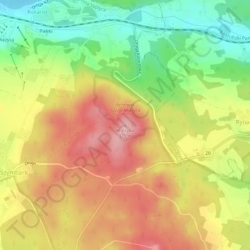
Nom : Carte topographique Wieżyca, altitude, relief.
Altitude moyenne : 247 m
Altitude minimum : 162 m
Altitude maximum : 325 m