
Carte topographique Tynda
Carte interactive
Cliquez sur la carte pour afficher l’altitude.
Tynda
The town is located at an elevation of 500 meters (1,600 ft) above sea level, near where the Getkan joins the Tynda River, after which the town was named. The Tynda then flows into the Gilyuy, a tributary of the Zeya, a few kilometers east of the town.
À propos de cette carte
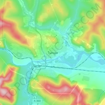
Nom : Carte topographique Tynda, altitude, relief.
Altitude moyenne : 566 m
Altitude minimum : 477 m
Altitude maximum : 766 m