
Carte topographique Gangtok district
Carte interactive
Cliquez sur la carte pour afficher l’altitude.
À propos de cette carte
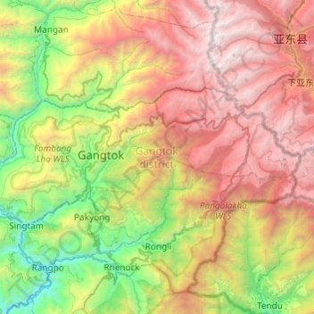
Nom : Carte topographique Gangtok district, altitude, relief.
Lieu : Gangtok district, Sikkim, India (27.23001 88.43785 27.42146 88.92137)
Altitude moyenne : 2 334 m
Altitude minimum : 233 m
Altitude maximum : 5 196 m
Autres cartes topographiques
Cliquez sur une carte pour visualiser sa topographie, son altitude et son relief.
Lachung
India > Sikkim > Chungthang
Lachung, Chungthang, North Sikkim District, Sikkim, India
Altitude moyenne : 3 617 m
Katao
India > Sikkim > Chungthang
Katao, Chungthang, North Sikkim District, Sikkim, India
Altitude moyenne : 4 505 m
East District
India > Sikkim > East District
East District, East Sikkim District, Sikkim, India
Altitude moyenne : 2 740 m