
Carte topographique Marienberg
Carte interactive
Cliquez sur la carte pour afficher l’altitude.
À propos de cette carte
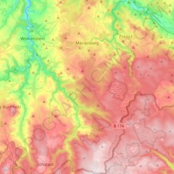
Nom : Carte topographique Marienberg, altitude, relief.
Lieu : Marienberg, Erzgebirgskreis, Saxony, 09496, Germany (50.50289 13.11699 50.69897 13.32772)
Altitude moyenne : 657 m
Altitude minimum : 360 m
Altitude maximum : 901 m
The town is situated on a plateau north of the Ore Mountain ridge, at an elevation between 460 and 891 metres above sea level. It is approximately 31 kilometres south of Chemnitz, to which it is connected via the Flöha Valley Railway.