
Carte topographique Joseph
Carte interactive
Cliquez sur la carte pour afficher l’altitude.
À propos de cette carte
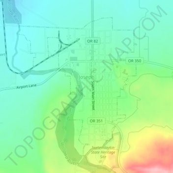
Nom : Carte topographique Joseph, altitude, relief.
Lieu : Joseph, Wallowa County, Oregon, 97846, United States (45.33959 -117.24665 45.36118 -117.22024)
Altitude moyenne : 1 285 m
Altitude minimum : 1 235 m
Altitude maximum : 1 404 m
According to the United States Census Bureau, the city has a total area of 0.88 square miles (2.28 km2), all of it land. The elevation is 4,190 feet (1,280 m) above sea level.