
Carte topographique Kellow Lake
Carte interactive
Cliquez sur la carte pour afficher l’altitude.
À propos de cette carte
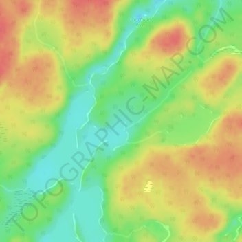
Nom : Carte topographique Kellow Lake, altitude, relief.
Altitude moyenne : 294 m
Altitude minimum : 264 m
Altitude maximum : 321 m
Autres cartes topographiques
Cliquez sur une carte pour visualiser sa topographie, son altitude et son relief.
Camp 36 Lake
Canada > Ontario > Thunder Bay District > Unorganized Thunder Bay District
Camp 36 Lake, Unorganized Thunder Bay District, Thunder Bay District, Northwestern Ontario, Ontario, Canada
Altitude moyenne : 269 m