
Carte topographique Pass
Carte interactive
Cliquez sur la carte pour afficher l’altitude.
À propos de cette carte
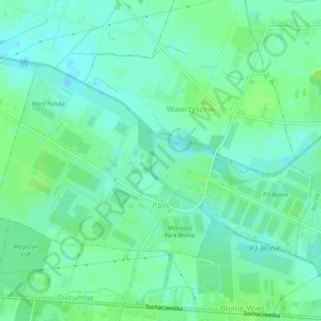
Nom : Carte topographique Pass, altitude, relief.
Altitude moyenne : 89 m
Altitude minimum : 83 m
Altitude maximum : 94 m
Autres cartes topographiques
Cliquez sur une carte pour visualiser sa topographie, son altitude et son relief.
Ożarów Mazowiecki
Poland > Masovian Voivodeship > Warsaw West County > Ożarów Mazowiecki
Ożarów Mazowiecki, gmina Ożarów Mazowiecki, Warsaw West County, Masovian Voivodeship, 05-850, Poland
Altitude moyenne : 98 m