
Carte topographique Hogsmill River
Carte interactive
Cliquez sur la carte pour afficher l’altitude.
À propos de cette carte
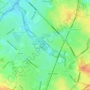
Nom : Carte topographique Hogsmill River, altitude, relief.
Altitude moyenne : 37 m
Altitude minimum : 21 m
Altitude maximum : 59 m
Autres cartes topographiques
Cliquez sur une carte pour visualiser sa topographie, son altitude et son relief.
Epsom Downs
United Kingdom > England > Epsom and Ewell
Epsom Downs, Epsom and Ewell, Surrey, South East, England, United Kingdom
Altitude moyenne : 118 m
Nonsuch Park
United Kingdom > England > Epsom and Ewell
Nonsuch Park, Stoneleigh, Epsom and Ewell, Surrey, South East, England, United Kingdom
Altitude moyenne : 50 m