
Carte topographique Solapur
Cliquez sur la carte pour afficher l’altitude.
Solapur
Solapur is located at 17°41′N 75°55′E / 17.68°N 75.92°E / 17.68; 75.92. It has an average elevation of 458 metres (1502 feet). It is bordered by Ahmednagar district on the north; Osmanabad district on the north and northeast.
À propos de cette carte
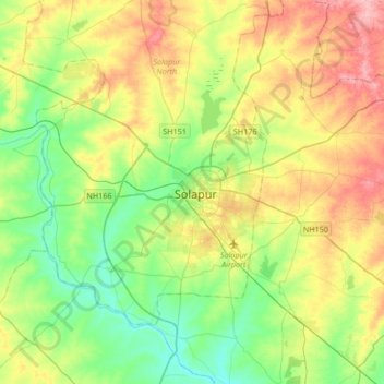
Nom : Carte topographique Solapur, altitude, relief.
Altitude moyenne : 469 m
Altitude minimum : 424 m
Altitude maximum : 541 m