
Carte topographique Covelo
Carte interactive
Cliquez sur la carte pour afficher l’altitude.
À propos de cette carte
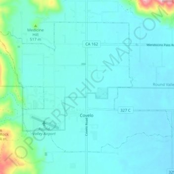
Nom : Carte topographique Covelo, altitude, relief.
Lieu : Covelo, Mendocino County, California, 95428, United States (39.78042 -123.28683 39.82439 -123.21033)
Altitude moyenne : 440 m
Altitude minimum : 407 m
Altitude maximum : 673 m
Covelo (/ˈkoʊvəloʊ/ KOH-və-loh) is a census-designated place (CDP) in Mendocino County, California, United States. Covelo is located 14 miles (23 km) east-northeast of Laytonville, at an elevation of 1,398 feet (426 m). The population was 1,394 at the 2020 census, up from 1,255 at the 2010 census. 405 acres (1.64 km2) of Covelo is part of the Round Valley Indian Reservation.