
Carte topographique New Forge
Carte interactive
Cliquez sur la carte pour afficher l’altitude.
À propos de cette carte
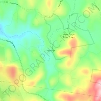
Nom : Carte topographique New Forge, altitude, relief.
Altitude moyenne : 193 m
Altitude minimum : 109 m
Altitude maximum : 319 m
Autres cartes topographiques
Cliquez sur une carte pour visualiser sa topographie, son altitude et son relief.
West Taghkanic
United States > New York > Columbia County > Town of Taghkanic
West Taghkanic, Town of Taghkanic, Columbia County, New York, United States
Altitude moyenne : 147 m
East Taghkanic
United States > New York > Columbia County > Town of Taghkanic
East Taghkanic, Town of Taghkanic, Columbia County, New York, 12521, United States
Altitude moyenne : 200 m