
Carte topographique Potosí
Carte interactive
Cliquez sur la carte pour afficher l’altitude.
À propos de cette carte
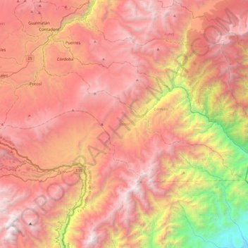
Nom : Carte topographique Potosí, altitude, relief.
Lieu : Potosí, Ex-Providencia de Obando, Nariño, Colombia (0.62733 -77.64267 0.84070 -77.18680)
Altitude moyenne : 2 713 m
Altitude minimum : 551 m
Altitude maximum : 4 193 m
Potosí features a rare climate for a city of its size, due to its extreme elevation at over 4000m. Semi-arid and with average temperatures in its warmest month sitting right on the 10 °C threshold, the city's climate straddles that of the subtropical highland climate (Cwc, according to the Köppen climate classification), with subpolar oceanic characteristics and an alpine climate (E). Summers are cool and wet with daily highs rarely rising above 20 °C, while winters feature cooler days with much colder nights averaging −4 °C. These low temperatures are a result of the extreme precipitation deficit during the winter months with the resulting aridity leading to an increased diurnal temperature variation.