
Carte topographique Ridgecrest
Carte interactive
Cliquez sur la carte pour afficher l’altitude.
À propos de cette carte
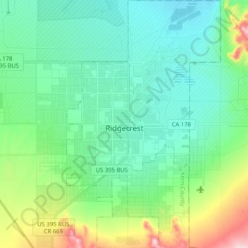
Nom : Carte topographique Ridgecrest, altitude, relief.
Lieu : Ridgecrest, Kern County, California, United States (35.56389 -117.70589 35.68079 -117.61640)
Altitude moyenne : 740 m
Altitude minimum : 667 m
Altitude maximum : 1 022 m
Walker Pass (elevation 5,250 ft (1.60 km)) is a mountain pass by Lake Isabella in the southern Sierra Nevada mountains. It is located in northeastern Kern County, approximately 53 mi (85 km) ENE of Bakersfield and 10 mi (16 km) WSW of Ridgecrest. The pass provides a route between the San Joaquin Valley on the west and the Mojave Desert on the east.