
Carte topographique Glendive
Carte interactive
Cliquez sur la carte pour afficher l’altitude.
À propos de cette carte
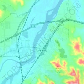
Nom : Carte topographique Glendive, altitude, relief.
Lieu : Glendive, Dawson County, Montana, 59330, United States (47.08425 -104.73924 47.13675 -104.67647)
Altitude moyenne : 647 m
Altitude minimum : 620 m
Altitude maximum : 771 m
The elevation of the city is 2,064 feet (629 m). Interstate 94 passes through town with access from exits 215, 224 and 231. Montana Highway 16 begins in West Glendive. The Yellowstone River cuts through town.