
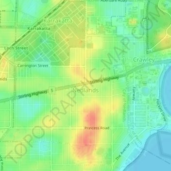
Carte topographique Nedlands
Carte interactive
Cliquez sur la carte pour afficher l’altitude.
À propos de cette carte
Nom : Carte topographique Nedlands, altitude, relief.
Altitude moyenne : 20 m
Altitude minimum : 0 m
Altitude maximum : 46 m
Due to its elevation, Nedlands is slightly cooler and wetter than the Perth central business district.
Autres cartes topographiques
Cliquez sur une carte pour visualiser sa topographie, son altitude et son relief.
Dalkeith
Australia > Western Australia > City of Nedlands
Dalkeith, City of Nedlands, Western Australia, Australia
Altitude moyenne : 14 m
Mount Claremont
Australia > Western Australia > City of Nedlands
Mount Claremont, City of Nedlands, Western Australia, Australia
Altitude moyenne : 23 m
Allen Park Bushland
Australia > Western Australia > City of Nedlands
Allen Park Bushland, Swanbourne, City of Nedlands, Western Australia, 6910, Australia
Altitude moyenne : 15 m