
Carte topographique El Tocuyo
Carte interactive
Cliquez sur la carte pour afficher l’altitude.
El Tocuyo
El Tocuyo is a fertile valley and city in west-central Venezuela at 622 m (2,041 ft) elevation. It is located in south-central Lara State about 60 km southwest of Barquisimeto. The town of El Tocuyo was founded by Juan de Carvajal in 1545 on the banks of the Tocuyo River and it was the administrative capital of Venezuela Province from 1546 to 1548. Its original name was Nuestra Señora de la Pura y Limpia Concepción del Tocuyo. El Tocuyo is now just the municipal seat of Morán. Its population is 41,327 (2001).
À propos de cette carte
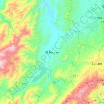
Nom : Carte topographique El Tocuyo, altitude, relief.
Lieu : El Tocuyo, Municipio Morán, Lara, Venezuela (9.62845 -69.95414 9.94845 -69.63414)
Altitude moyenne : 1 081 m
Altitude minimum : 538 m
Altitude maximum : 2 497 m