
Carte topographique Kolašin
Carte interactive
Cliquez sur la carte pour afficher l’altitude.
Kolašin
Kolašin is located on the foot of Bjelasica and Sinjajevina mountains, which offer great conditions for skiing. Because of Kolašin's altitude (954 m), the town is considered an air spa.
À propos de cette carte
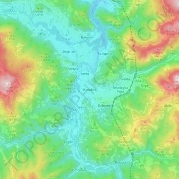
Nom : Carte topographique Kolašin, altitude, relief.
Lieu : Kolašin, Kolašin Municipality, 81210, Montenegro (42.78385 19.48180 42.86385 19.56180)
Altitude moyenne : 1 133 m
Altitude minimum : 897 m
Altitude maximum : 1 669 m